Introduction
Light Detection and Ranging (LiDAR) technology has revolutionized spatial data collection, offering precise, high-resolution mapping capabilities. However, the integration of Artificial Intelligence (AI) with LiDAR has taken this technology to the next level. AI enhances LiDAR’s efficiency, accuracy, and applicability in industries like autonomous vehicles, urban planning, agriculture, and more.
In this comprehensive article, we’ll explore:
- What LiDAR technology is and how it works
- The role of AI in enhancing LiDAR data processing
- Key applications of AI-powered LiDAR across industries
- The challenges and future of LiDAR-AI integration
Let’s dive deep into this transformative technology and how it’s reshaping our world.
What is LiDAR Technology?
Understanding LiDAR
LiDAR is a remote sensing method that measures distances using laser pulses. By emitting light and analyzing the reflection time, LiDAR systems generate detailed, three-dimensional (3D) representations of objects and landscapes. This makes it a vital tool for mapping, navigation, and automation.
How Does LiDAR Work?
- Emission of Laser Pulses – A LiDAR sensor sends out rapid laser pulses, often in the infrared spectrum.
- Reflection from Surfaces – The pulses bounce off objects, such as buildings, trees, or roads.
- Time of Flight Calculation – The system calculates the time taken for the light to return.
- Data Processing – The LiDAR software translates these reflections into a precise 3D point cloud.
Types of LiDAR Systems
- Aerial LiDAR – Mounted on drones, planes, or satellites to map large areas.
- Terrestrial LiDAR – Used on the ground, often in vehicles or static installations.
- Mobile LiDAR – Attached to moving vehicles for dynamic data collection.
LiDAR is widely used in industries such as autonomous driving, robotics, forestry, and archaeology. However, raw LiDAR data is often complex and vast, which is where Artificial Intelligence (AI) steps in.
The Role of Artificial Intelligence in LiDAR Technology
Why AI is Needed for LiDAR?
LiDAR generates enormous amounts of data, making manual processing inefficient. AI algorithms provide automation, pattern recognition, and predictive capabilities, improving real-time analysis and decision-making.
How AI Enhances LiDAR Data Processing
- Object Detection & Classification – AI can identify vehicles, pedestrians, and obstacles in LiDAR scans.
- Point Cloud Segmentation – Separates different objects, such as roads, trees, or buildings, from a complex dataset.
- Noise Reduction – Filters out irrelevant data points, improving accuracy.
- Predictive Analytics – AI can anticipate changes in the environment, aiding in navigation and planning.
AI-powered LiDAR is transforming multiple industries, especially in autonomous systems and smart cities.
Applications of AI-Powered LiDAR
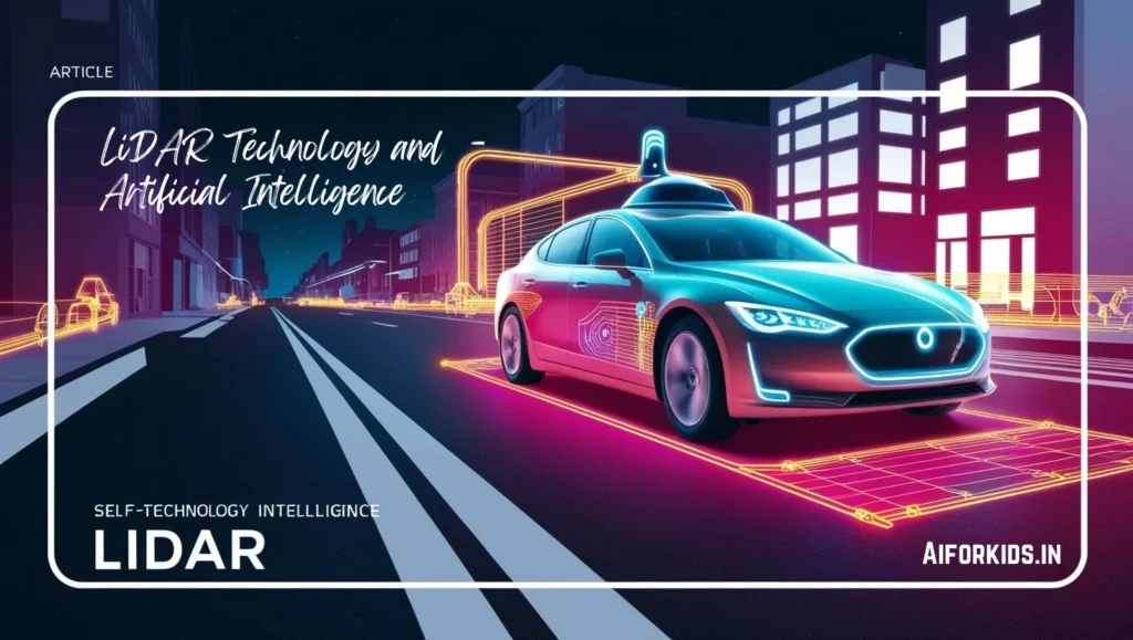
1. Autonomous Vehicles
AI-powered LiDAR plays a critical role in self-driving cars by:
- Mapping 3D environments for navigation
- Detecting obstacles like pedestrians, cyclists, and other vehicles
- Enhancing perception systems by fusing LiDAR with cameras and radar
Companies like Tesla, Waymo, and Uber are investing heavily in AI-enhanced LiDAR for safer and more efficient self-driving technology.
2. Urban Planning & Smart Cities
AI-integrated LiDAR is used for:
- Mapping city landscapes for urban development
- Traffic monitoring to optimize roads and intersections
- Infrastructure inspection to detect structural issues
Example: Singapore uses AI-powered LiDAR for real-time traffic flow analysis and urban planning.
3. Agriculture & Forestry
In precision farming, AI-powered LiDAR helps:
- Monitor crop health and soil conditions
- Detect pests, diseases, and nutrient deficiencies
- Automate irrigation and harvesting
Forestry applications include forest density analysis, wildfire prediction, and conservation planning.
4. Disaster Management & Emergency Response
AI-enhanced LiDAR helps:
- Assess disaster zones (earthquakes, floods, wildfires)
- Plan evacuation routes with real-time hazard mapping
- Monitor infrastructure damage after natural disasters
Example: AI-powered LiDAR was used in California’s wildfire management, helping firefighters track fire spread and assess risks.
5. Security & Surveillance
LiDAR combined with AI is used in border security, military applications, and smart surveillance systems. AI enables:
- Intruder detection in restricted areas
- Facial recognition in crowded spaces
- Threat assessment for law enforcement
6. Augmented Reality (AR) & Virtual Reality (VR)
LiDAR and AI improve AR/VR experiences by:
- Creating accurate digital replicas of real-world environments
- Enhancing 3D object interaction for immersive applications
- Powering motion tracking for gaming and training simulations
Apple’s LiDAR scanner in iPhones and iPads enhances AR capabilities for developers and consumers.
Learn more about LiDAR technology here
Challenges in AI-Powered LiDAR
While AI-powered LiDAR presents technological hurdles, ongoing advancements in AI, sensor miniaturization, and computational efficiency are paving the way for its widespread adoption and improved performance. ????
Despite its benefits, integrating AI with LiDAR poses some challenges:
1. High Costs
- Expensive Sensors & AI Processing – LiDAR sensors, especially high-resolution ones, remain costly, making widespread adoption difficult.
- Solution: Companies are working on affordable solid-state LiDAR for cost reduction.
2. Massive Data Processing Requirements
- Complexity of Point Clouds – LiDAR generates vast amounts of raw data, requiring high computational power for AI to process in real-time.
- Solution: Advancements in cloud computing and edge AI can enhance efficiency.
3. Environmental Limitations
- Weather Sensitivity – Rain, fog, and dust can impact LiDAR accuracy, leading to potential errors in AI analysis.
- Solution: AI models are being trained to compensate for environmental distortions.
4. Privacy & Security Concerns
- Surveillance Risks – AI-powered LiDAR used in public spaces raises concerns about data privacy and tracking.
- Solution: Governments need to implement ethical regulations and policies for responsible AI-LiDAR use.
5. Integration Challenges
- Hardware & Software Compatibility – LiDAR must seamlessly integrate with AI, cameras, and radar for autonomous systems and robotics.
- Solution: Standardized software frameworks and AI models are being developed for better compatibility.
6. Power Consumption
- AI-driven LiDAR requires significant energy, which can be an issue in battery-operated systems like drones and autonomous vehicles.
- Solution: Optimized AI algorithms and energy-efficient LiDAR sensors are under development.
Future of LiDAR and AI
With rapid advancements in AI algorithms and LiDAR technology, we are heading toward a future where LiDAR will be an integral part of autonomous systems, smart infrastructure, and daily consumer tech. ????
1. Miniaturization of LiDAR Sensors
- Companies are developing smaller, more affordable LiDAR sensors for widespread adoption.
- Example: Apple’s LiDAR-enabled iPhones for AR applications.
2. AI-Driven Automation
- AI will further automate LiDAR data analysis, making real-time insights more accessible.
3. LiDAR in Everyday Applications
- Expect LiDAR in home automation, personal devices, and healthcare applications.
4. 5G & Edge Computing Integration
- Combining 5G connectivity with AI-powered LiDAR will enable faster, real-time decision-making.
5. Advancements in AI Algorithms
- More efficient deep learning models will improve the accuracy and speed of LiDAR data processing.
Conclusion
The integration of LiDAR and Artificial Intelligence is shaping the future of autonomous systems, smart cities, agriculture, and security. While challenges remain, advancements in AI and sensor technology will drive greater adoption, efficiency, and affordability.
For an in-depth guide on LiDAR technology, check out ARVR Hub’s detailed article.
FAQs
1. What is the advantage of combining AI with LiDAR?
AI makes LiDAR data processing faster, more accurate, and applicable for real-time decision-making in autonomous vehicles, robotics, and surveillance.
2. How is AI used in LiDAR-based autonomous cars?
AI interprets LiDAR data to detect objects, predict movements, and navigate roads safely.
3. What are some challenges in AI-powered LiDAR?
Cost, high computational requirements, weather conditions, and privacy concerns are major challenges.
4. How does LiDAR contribute to smart cities?
AI-powered LiDAR maps city infrastructure, monitors traffic, and improves public safety.
5. Is LiDAR used in AR and VR?
Yes, LiDAR enhances 3D scanning, motion tracking, and AR applications on devices like iPhones and VR headsets.